Learn how to see lava in Hawaii: how Kilauea eruption activity changes what you can see, the best viewpoints, and when to go for night glow.
How Eruption Activity Changes What You See
Figuring out how to see lava in Hawaii starts with one uncomfortable fact: there's no permanent lava show. Kilauea, on the Big Island, is one of the most active volcanoes on Earth, but its eruptions are intermittent, shifting between quiet dormancy, summit lava lakes, and occasional flank eruptions that send flows toward the coast. What you can see on any given trip depends entirely on which phase it's in when you land.
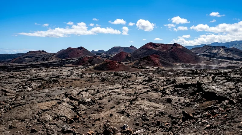
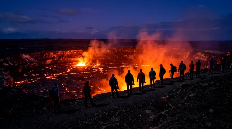
Some visitors arrive during a summit eruption and watch a lava lake churn inside Halemaʻumaʻu crater, visible from overlooks a mile or more away. Others arrive during a pause and see only steam vents and a scarred caldera — still worth the trip, but not the postcard image people expect. Flank eruptions that reach the ocean, like the 2018 Kīlauea lower East Rift Zone event that buried parts of Kalapana, are rarer and unpredictable, sometimes lasting weeks, sometimes months.
I'd rather be honest here than sell you a fantasy: don't book a Hawaii trip purely on the promise of lava. Book it for the volcano landscape, the national park, the Big Island's other attractions — and treat an active eruption as a bonus if the timing lines up.
Summit Eruptions vs. Flank Flows
Summit eruptions happen within Halemaʻumaʻu crater at Kilauea's summit, inside Hawaii Volcanoes National Park, and are the most commonly viewable type in recent years. You watch from established overlooks, often from a few hundred yards to over a mile away — safe, legal, and usually accessible by car plus a short walk.
Flank or rift zone eruptions break out along Kilauea's east or southwest rift zones, sometimes well outside the park, occasionally threatening roads and homes. These can produce flows that reach the ocean, creating the dramatic steam plumes you've seen in photos. They're also far less predictable and sometimes require boat tours or helicopter access rather than roadside viewing, since the ground near active flows is closed for safety.
Checking Current Status Before You Go
Before booking flights, check two sources: the USGS Hawaiian Volcano Observatory website for eruption status and hazard updates, and the Hawaii Volcanoes National Park website or its social media for access and trail closures. Both update frequently during active eruptions, sometimes daily. Don't rely on tour operator marketing or outdated blog posts — conditions can change within days, and a viewpoint open last month may be closed now due to gas emissions or ground cracking.
Best Viewpoints in Hawaii Volcanoes National Park
Hawaii Volcanoes National Park, about 45 minutes from Hilo and roughly 2.5 hours from Kona, is the reliable base for lava viewing regardless of what's erupting. Entry runs around $30 per vehicle, valid for seven days — good value if you're spending a few days on the Big Island, since it covers multiple visits for sunrise, midday hiking and nighttime glow viewing.
The park's road network puts several overlooks within easy reach of parking, which matters if you're traveling with older relatives or kids who won't want a long hike after a day at the beach.
Keanakāko'i Overlook offers the closest easy-access summit view, while ocean-entry flows (when active) require boat or air tours instead of a short walk.
Hawaii lava and volcano viewpoints compared: distance, access and best use
| Viewpoint | Distance from Parking | Access | Best For |
|---|---|---|---|
| Keanakāko'i Overlook | Approx. 0.5 mile one-way | Paved path | Closest summit crater view |
| Uēkahuna | Roadside | Short walk, exposed | Wide caldera panorama |
| Wahinekapu (Steaming Bluff) | Roadside | Flat, short | Steam vents, no eruption needed |
| Kupina'i Pali | Approx. 1 mile one-way | Trail, uneven in spots | Quieter dusk photography |
| Kalapana ocean entry (if active) | Variable, often miles | Boat tour or closed hike | Lava meeting the ocean |
Access and distances change with active closures; confirm current status with the National Park Service before visiting.
Crater Rim Trail Overlooks
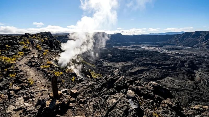
The Crater Rim Trail loops along the edge of Kilauea's summit caldera and connects most of the park's best viewpoints on foot, with sections also accessible by car via Crater Rim Drive. Keanakāko'i Overlook, reached by a flat paved path of about a mile round-trip, is one of the closer vantage points to Halemaʻumaʻu and often the first recommendation during active summit eruptions. Kupina'i Pali, on the southwest side, offers a different angle and tends to be less crowded, useful if you want quieter photography conditions at dusk.
Uēkahuna and Keanakāko'i Areas
Uēkahuna, near the Jaggar Museum site, sits on the caldera's rim and is one of the highest, most exposed viewpoints — windy, often cooler than the coast, so bring a layer even in summer. Wahinekapu, known as Steaming Bluff, is worth a stop even without an eruption, since its ground-level steam vents are active year-round and give a visceral sense of the geology beneath your feet. None of these spots require a permit beyond the park entrance fee, and all are wheelchair-and-stroller-navigable to varying degrees, though surfaces can be uneven near the rim edges.
Seeing Lava Glow at Night
Night is when lava viewing in Hawaii actually delivers on the hype. During daylight, a distant lava lake can look like dull orange rock; after dark, that same crater throws a red glow against the sky that's visible from overlooks a mile or more away, no binoculars required. This is the single most dependable "see lava" experience in the islands when Kilauea's summit is active, and it doesn't require a permit, a guide or any hiking beyond the paved paths already mentioned.
Best Hours for Glow
Arrive at an overlook around 30–45 minutes before sunset to claim a parking spot and see the transition from daylight to glow, which is often more dramatic than full darkness alone. The hour just after sunset and the hour before sunrise tend to offer the best contrast — dark enough for the glow to read clearly, but not so late that you're navigating unlit trails. Parking at popular overlooks like Keanakāko'i fills up fast during confirmed active periods, so budget extra time and patience, especially on weekends.
Photography Tips for Low Light
A tripod matters more than an expensive camera here — even a basic one lets you shoot at slower shutter speeds, a half-second to several seconds, without blur. Smartphone night modes handle distant glow reasonably well, but a dedicated camera with manual exposure will capture more color depth in the crater. Skip flash entirely; it does nothing at this distance and annoys everyone around you. Dress warmer than you think you'll need — the summit sits around 4,000 feet elevation and temperatures drop fast after dark, even though the coast stays warm.
Timing, Weather and Seasonal Considerations
There isn't a strict "best season" for the best time to see lava in Hawaii the way there is for whale watching or surf season — eruption timing is geological, not calendar-driven. That said, a few practical seasonal factors shape the experience. Winter (November to March) brings more rain and cloud to the summit area, which sits in a wetter microclimate than Kona's leeward coast, so pack a rain layer regardless of what the beach forecast says. Summer offers more consistently clear evenings for glow viewing, though trade winds can blow vog — volcanic smog — toward or away from viewpoints depending on direction.
Cloud, Vog and Rain Effects
Vog is sulfur dioxide haze from active vents, and it can reduce visibility at overlooks or trigger air quality advisories, particularly for people with asthma or respiratory conditions. The park posts current air quality readings, and it's genuinely worth checking before you commit to an evening visit — a heavy vog day can turn a clear crater view into a gray haze with little glow visible. Rain and cloud cover do the same thing from the opposite direction, blanketing the caldera in mist. If your schedule allows it, build in two visit windows during your stay rather than betting everything on one evening.
Guided Tours vs. Independent Viewing
Most summit glow viewing in Hawaii Volcanoes National Park doesn't require a guide — you drive in, park, walk a paved path, and look. That's the main reason I'd steer most travelers toward independent viewing first: it's cheaper, flexible around weather, and you control your own timing for sunset or sunrise glow.
Tours earn their cost in two specific scenarios: when active flows are reaching the ocean outside the park's easy-access areas, and when you want expert narration on geology and eruption history that a sign at an overlook won't give you.
When a Tour Makes Sense
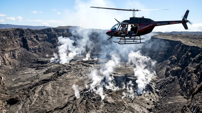
Boat tours that approach an active ocean entry from the water, when conditions allow, are often the only legal and safe way to get close to flowing lava reaching the sea — the coastal land near such flows is typically closed to foot traffic due to unstable new rock and toxic steam. Helicopter tours offer aerial views of both summit calderas and remote flow fields that are otherwise inaccessible, useful if an eruption is happening in a rift zone far from any road. Expect these specialized tours to be weather- and activity-dependent, with trips cancelled or rerouted if conditions aren't safe — compare current boat and helicopter tour options and prices before you book, and confirm cancellation policies given how fast eruption status can change.
Hiking to Flows on Public Land
During some past eruptions, rangers have opened guided or permitted hikes across the Kahaualeʻa Trail or similar routes to view surface flows on public land, sometimes several miles round-trip over rough, sharp lava rock in full sun with no shade or water sources. These hikes are physically demanding and only available when conditions are stable enough for NPS to allow it — treat any mention of "lava hiking" from older articles with skepticism unless you've confirmed it's currently permitted.
Safety and Accessibility Basics
Volcanic terrain is unforgiving in ways that aren't always obvious to first-time visitors. Thin crusts can form over hot ground, cliff edges near the caldera have collapsed unpredictably in the past, and sulfur dioxide gas can be dangerous in concentrated pockets even far from visible lava. None of this should scare you off — millions of people visit safely every year — but it does mean sticking to marked trails and posted boundaries isn't optional caution, it's the actual rule.
Volcanic Hazards and Closures
The park closes areas quickly when hazards increase, including sections of Crater Rim Drive and Trail near Halemaʻumaʻu, which has had a larger, deeper collapse zone since 2018 than it did decades ago. Never cross barriers for a better photo — rangers cite this as a recurring and entirely preventable cause of injury. Check the park's alert page the morning of your visit, since closures can appear with little warning after gas emission spikes.
Accessible Viewpoints
If you're traveling with a wheelchair, stroller, or limited mobility, Uēkahuna and Wahinekapu both have paved, relatively flat access from parking areas, making them the most practical choices in the park. Keanakāko'i's path is paved but longer, around a mile round-trip, so budget more time. Avoid Kupina'i Pali and any unpaved rift zone roads if mobility is a concern — footing is uneven and there's minimal shade or seating.
Frequently asked questions
Can you see active lava in Hawaii right now?
It depends entirely on current eruption status, which changes over weeks or months. Check the USGS Hawaiian Volcano Observatory site and the Hawaii Volcanoes National Park alerts page before booking travel — don't rely on older articles or tour marketing, since Kilauea cycles between active and quiet phases unpredictably.
What is the best time to see lava glow at night?
Arrive at a summit overlook like Keanakāko'i about 30–45 minutes before sunset during a confirmed active period, and stay through the first hour of full darkness for the strongest contrast. Pre-dawn, roughly an hour before sunrise, offers similar conditions with smaller crowds.
Can you visit Kilauea volcano without a tour?
Yes — most summit viewing happens independently. You pay the park entrance fee (around $30 per vehicle), drive to an overlook like Uēkahuna or Keanakāko'i, and walk a short paved path. Tours mainly add value for ocean-entry flows or aerial views you can't reach on foot.
Which viewpoint offers the closest lava viewing?
Keanakāko'i Overlook is typically the closest easily accessible vantage point to Halemaʻumaʻu crater during summit eruptions, reached by about a half-mile paved walk from parking. Exact distance to visible lava depends on current activity and any temporary closures.
Can you see lava flowing into the ocean?
Only during specific flank eruptions when flows reach the coast, which has happened at Kalapana and other East Rift Zone areas in past events. When it occurs, the closest legal views are usually from boat tours offshore, since the land near an active ocean entry is typically closed for safety.